Oxford County Agricultural Systems Approach
This project examines agricultural systems planning in Oxford County, including agricultural land preservation, rural development pressures, and implementation of Ontario's Provincial Planning Statement (2024).
Course: RPD 6280 – Planning Practice
Institution: University of Guelph
Date: April 2026
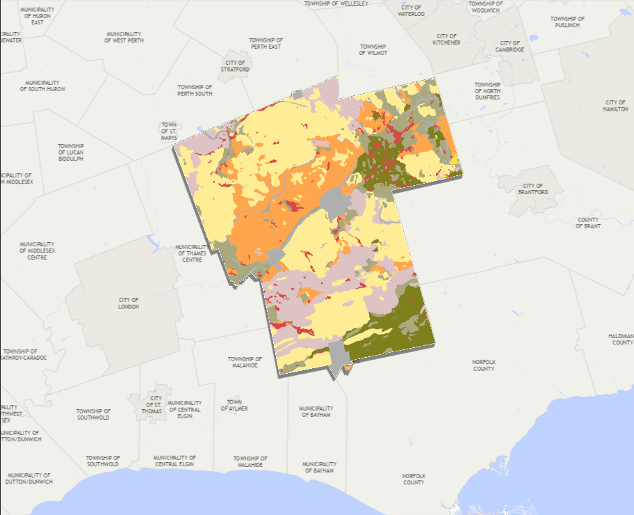
Figure 1. Existing land use conditions in Oxford County. The map highlights the spatial distribution of agricultural lands, natural heritage features, settlement areas, and other land use classifications. Understanding these patterns is essential for agricultural systems planning, as they influence agricultural land preservation, growth management, environmental conservation, and long-term rural economic development. Data were sourced from Ontario's Geographic Land Information and Mapping Resource (GLIMR).
This report evaluates how Oxford County can strengthen its Agricultural Systems Approach while protecting prime farmland, supporting agricultural viability, and managing future growth.
Key themes include agricultural preservation, land-use planning, settlement boundary pressures, rural economic development, and long-term food system resilience.
Open Full ReportKey Findings
- Strengthen protection of prime agricultural lands.
- Improve coordination between agricultural planning and economic development.
- Align Oxford County policies with PPS 2024 requirements.
- Support long-term viability of the agricultural land base and agri-food network.